• Contact
Logo Logo Logo Logo Logo
  • Home
  • Our Story
  • Destinations
  • Travel Stories
    • All Blog Posts
    • Adventure Categories
  • Photography
  • Videos
  • Home
  • Our Story
  • Destinations
  • Travel Stories

    • All Blog Posts
    • Adventure Categories
  • Photography
  • Videos
Bahia Honda State Park, Florida Keys

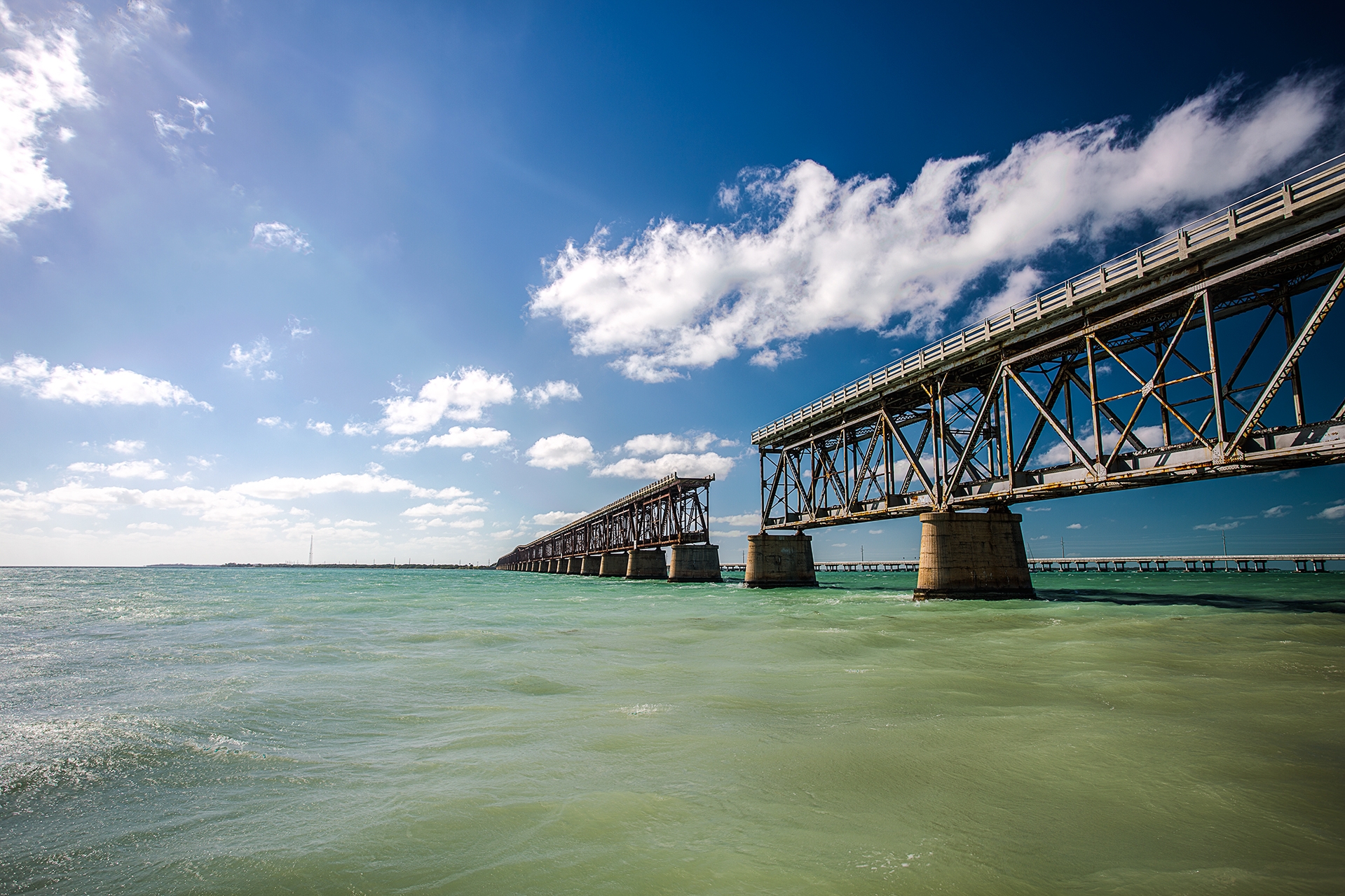
08 Mar 19 Things to Do in the Florida Keys That Will Make you Fall in Love with the Islands

Posted at 09:15h in Blog, Florida, The Florida Keys, United States

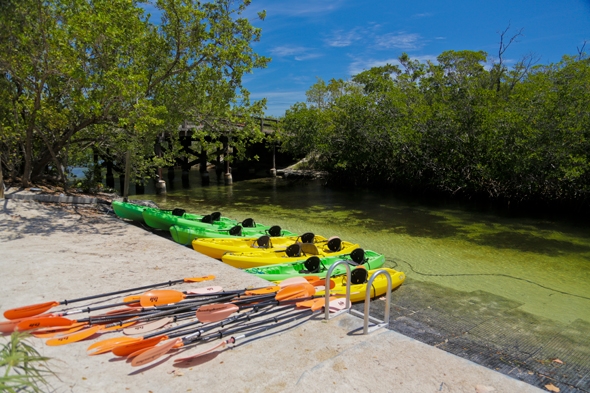
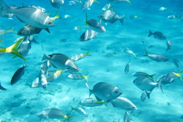
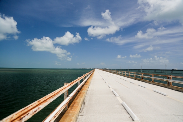
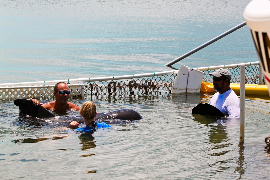
The Florida Keys are one of our favorite places—over the years, we have spent many a day exploring this tropical slice of Florida. While there are so many adventures we have yet to try in the Keys, we wanted to share our personal favorites with...

Read More
Kayaking at John Pennekamp State Park

09 May Kayaking Through the Mangroves at John Pennekamp State Park

Posted at 11:12h in Blog, Florida, Outdoor Adventure, The Florida Keys, United States

Twisting and turning our way through, we arched back to skim under the low hanging trees. As we maneuvered our kayaks carefully towards the other side of the mangrove cluster, I wondered if we were on the right path. The path we chose, was indeed...

Read More
Snorkeling in Islamorada, Florida

25 Feb Snorkeling at Alligator Reef in the Florida Keys

Posted at 09:16h in Blog, Florida, Outdoor Adventure, The Florida Keys, United States

The only living coral barrier reef in the United States, also happens to be one of the largest reef systems in the world. Where is this reef located you may ask? Well, it is located in the Florida Keys, and we are lucky enough to...

Read More
Road Trip through the Florida Keys

25 Oct Road Trip Through the Florida Keys: Essential Stops

Posted at 09:20h in Blog, Florida, The Florida Keys, United States, Urban Adventure

The Florida Keys are a special place. Rough on the outside, as many Caribbean destinations are, but underneath there is a welcoming charm, the type you can only get from an unhurried seaside town. Although the Keys are not technically in the Caribbean, you are...

Read More

26 Sep Volunteering with the Pilot Whale Rescue Efforts in Key Largo, FL

Posted at 21:51h in Blog, Florida, Outdoor Adventure, The Florida Keys, United States

In May of 2011, there was a mass stranding of 23 pilot whales in the Florida Keys; they were found beached near Cudjoe Key, which is located around 20 miles north of Key West.  The Marine Mammal Conservancy Organization (MMC) rushed to help and located...

Read More
About Wander The Map
  • Home
  • Our Story
  • Blog
  • Contact
  • Privacy Policy
  • Terms & Conditions
  • View wanderthemap’s profile on Facebook
  • View wanderthemap’s profile on Twitter
  • View wanderthemap’s profile on Instagram
  • View wanderthemap’s profile on Pinterest
  • View wanderthemap’s profile on YouTube
Subscribe:
Sign up via email to receive our FREE monthly breakdown which includes photo of the month, money saving tips and adventure travel advice!
Follow on Instagram

wanderthemap

At first, Badwater Basin in Death Valley National At first, Badwater Basin in Death Valley National Park doesn’t look like much, but when you learn more about this piece of land, it’s quite interesting. Badwater Basin is the lowest elevation point in North America, at 282 ft below sea level. The land here is made up of a salt flat that stretches nearly 200 square miles. If you look hard for the tiny white sign in the mountains in the 5th photo (straight up above the Cruise America RV) you can see where sea level is. Standing on the salt flat and looking up at the sea level sign really puts the low elevation into perspective! We couldn’t help but imagine standing at the bottom of the lake that once covered this area.

We walked about a mile out onto the flats and loved seeing all the salt polygons and unique formations all around us. The farther we walked the less people we saw, and it was quite peaceful during our sunset stroll. We ended up visiting Badwater Basin twice during our trip, and I already want to head back again. There’s just so much to see if you take the time to look!
When standing at the Zabriski Point Lookout in Dea When standing at the Zabriski Point Lookout in Death Valley National Park, you overlook stunning hills and canyons of the Badlands. And if you look close, you might see people hiking far out on the landscape. One of the trails that runs through this area is the Badlands Loop, and it is a fantastic option for a hike!  Wandering through the narrow canyons and up along the hills of the Badlands provides a beautiful vantage point of this colorful area. 

The Badlands Loop is a 2.7 mile trail that runs through the gulch and up along the top of the ridges. There isn’t much shade on this trial, especially if you hike it during the heat of the day, so try to avoid a midday hike here when the temperatures are high. There are several trails that intersect in this area; you can connect to both the Gower Gulch Trail and the Golden Canyon Trail to make it one longer 7.8 mile loop hike. We hiked Golden Canyon earlier on our trip, so this time around we just hiked the Badlands Loop. Photos 1-8 are from the Badlands Loop trail, and 9-10 are from the Zabriski Point overlook the day prior when the skies were much more cloudy!
We spent 2.5 days exploring Death Vally National P We spent 2.5 days exploring Death Vally National Park this past winter, and we sure packed a lot into our visit. Hiking the wide variety of trails was our favorite way to explore the park. All of the trails were fantastic, but the Mesquite Flat Sand Dunes was one of our favorite stops. We visited the dunes several times during our three days in the park, and each visit was at a different time of day. We were there for sunset, at night to see the stars, and at sunrise. When we went for sunrise, we hiked our way out to the summit of the tallest dune. The summit is roughly 1 mile from the parking lot, although there is no formal trail to get there and back. 

Along the hike, we spotted someone painting the sunrise from the top of one of the dunes. We couldn’t help but stop and chat with her and Micah snapped a few photos—we absolutely loved her artwork! We also enjoyed finding lots of animal prints in the sand. Even though the distance was short, the hike was tough as the sand is very hard to walk on. It felt like every step forward equaled two steps back! But the feeling you get from conquering the tallest dune is well worth it. It’s a beautiful portion of the park to explore!
Well, it’s certainly been a bit since we last po Well, it’s certainly been a bit since we last posted! We took a pause from sharing on social media and on our blog the last several months. A lot has happened around here, good, bad, and a lot in between, and we really needed some time to reflect and refocus our energy. If you’d like to hear more about what we’ve been up to, feel free to check out our most recent newsletter at the link in our profile. ⁣
⁣
Anyways, we are back it it, and slowly but surely starting to share our travels again. Over the past year, we’ve been to several national parks, and we have plans to visit several more this summer—we can’t wait! Most of these past park visits coincided with work projects, and outside of that, we haven’t had much time to travel for fun. Luckily, we did manage to take one trip this past February. We made our way to Las Vegas, and from there, we took a road trip to Joshua Tree National Park and Death Valley National Park. ⁣
⁣
We are going to start off by sharing the adventures we had on that trip next. But first, here is a photo from our super quick stop at Saguaro National Park in Tucson, AZ. We had a few hours to kill before heading to the airport, so we only had time to drive the Cactus Forest Drive in the east section of the park. Even though it was a quick stop, we were glad we got to check it out!
Follow on Instagram
Search


DMCA.com Protection Status

Copyright © Wander The Map 2020