• Contact
Logo Logo Logo Logo Logo
  • Home
  • Our Story
  • Destinations
  • Travel Stories
    • All Blog Posts
    • Adventure Categories
  • Photography
  • Videos
  • Home
  • Our Story
  • Destinations
  • Travel Stories

    • All Blog Posts
    • Adventure Categories
  • Photography
  • Videos
Canoeing Ham Lake, Tuscarora Lodge, Gunflint Trail, Minnesota

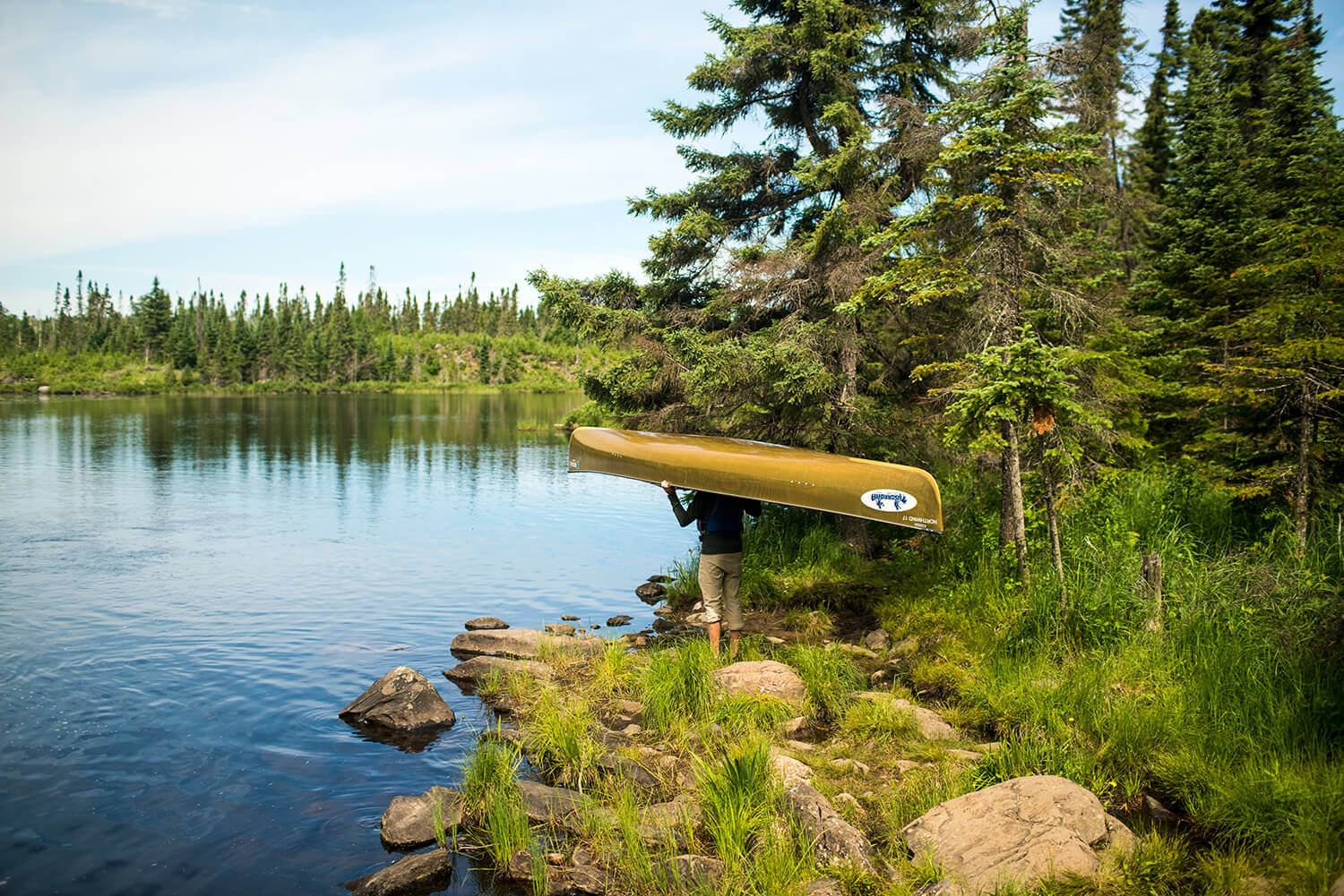
05 Aug Portaging and Paddling: Canoeing to Ham Lake on the Gunflint Trail

Posted at 09:50h in Blog, Minnesota, Outdoor Adventure, United States

Located in the far reaches of northern Minnesota, lies the wilderness of the Gunflint Trail and the Boundary Waters Canoe Area Wilderness (BWCA). This area is dotted with forests, lakes, rivers, wildlife, and beautiful vistas in every direction. One of the most popular adventures in...

Read More
Canoeing at Moraine Lake in Banff National Park, Alberta, Canada

14 Jun Canoeing at Moraine Lake in Banff National Park

Posted at 12:30h in Alberta, Blog, Canada, National Parks, Outdoor Adventure

I hadn't been this giddy in quite some time. I'm not sure if it was the sight of crystal clear turquoise waters that twinkled under the sun or the fact that we were out paddling again, this time with rocky mountains and glaciers towering all...

Read More
Canoeing the Chain of Lakes in Minneapolis, Minnesota

03 Oct Canoeing the Chain of Lakes in Minneapolis

Posted at 10:25h in Blog, Minnesota, United States, Urban Adventure

Minnesota isn’t called the “Land of 10K Lakes” for nothing—in fact, there are actually more than 10,000 lakes throughout the state. Also, Minnesota has more shoreline than Florida, California and Hawaii combined! All of this means that growing up in Minnesota equates to spending the...

Read More
About Wander The Map
  • Home
  • Our Story
  • Blog
  • Contact
  • Privacy Policy
  • Terms & Conditions
  • View wanderthemap’s profile on Facebook
  • View wanderthemap’s profile on Twitter
  • View wanderthemap’s profile on Instagram
  • View wanderthemap’s profile on Pinterest
  • View wanderthemap’s profile on YouTube
Subscribe:
Sign up via email to receive our FREE monthly breakdown which includes photo of the month, money saving tips and adventure travel advice!
Follow on Instagram

wanderthemap

Jenna & Micah • Wander The Map
Hey, it’s been awhile! Popping back in to share Hey, it’s been awhile! Popping back in to share a bit about our recent weekend trip to Denver. We watched a baseball game at Coors Field followed by Sandlot on the scoreboard, explored the crazy world of Meow Wolf’s Convergence Station, saw Gregory Alan Isakov and Jeremiah Fraites perform at Red Rocks Amphitheater, and ate at some great restaurants. It was a quick trip, but we sure packed a lot in!
Another hike that we went on during our time in De Another hike that we went on during our time in Death Valley National was the Golden Canyon Trail with the Red Cathedral extension! We really enjoyed the landscape throughout this hike—it was another one of our favorite trails in Death Valley. The trail is 1.5 miles each way (3 miles round trip), and the last 0.5 miles of the trail, aka the Red Cathedral Trail, requires some scrambling, ledges, and low overhangs.

The Golden Canyon/Red Cathedral trail was so fun and we loved weaving through, under, and over tight rock formations. Plus, the views at the end of the trail were beautiful. Apparently, some scenes from Star Wars were filmed in this area, and I can see why—it looked like we were walking through an entirely different world!
At first, Badwater Basin in Death Valley National At first, Badwater Basin in Death Valley National Park doesn’t look like much, but when you learn more about this piece of land, it’s quite interesting. Badwater Basin is the lowest elevation point in North America, at 282 ft below sea level. The land here is made up of a salt flat that stretches nearly 200 square miles. If you look hard for the tiny white sign in the mountains in the 5th photo (straight up above the Cruise America RV) you can see where sea level is. Standing on the salt flat and looking up at the sea level sign really puts the low elevation into perspective! We couldn’t help but imagine standing at the bottom of the lake that once covered this area.

We walked about a mile out onto the flats and loved seeing all the salt polygons and unique formations all around us. The farther we walked the less people we saw, and it was quite peaceful during our sunset stroll. We ended up visiting Badwater Basin twice during our trip, and I already want to head back again. There’s just so much to see if you take the time to look!
When standing at the Zabriski Point Lookout in Dea When standing at the Zabriski Point Lookout in Death Valley National Park, you overlook stunning hills and canyons of the Badlands. And if you look close, you might see people hiking far out on the landscape. One of the trails that runs through this area is the Badlands Loop, and it is a fantastic option for a hike!  Wandering through the narrow canyons and up along the hills of the Badlands provides a beautiful vantage point of this colorful area. 

The Badlands Loop is a 2.7 mile trail that runs through the gulch and up along the top of the ridges. There isn’t much shade on this trial, especially if you hike it during the heat of the day, so try to avoid a midday hike here when the temperatures are high. There are several trails that intersect in this area; you can connect to both the Gower Gulch Trail and the Golden Canyon Trail to make it one longer 7.8 mile loop hike. We hiked Golden Canyon earlier on our trip, so this time around we just hiked the Badlands Loop. Photos 1-8 are from the Badlands Loop trail, and 9-10 are from the Zabriski Point overlook the day prior when the skies were much more cloudy!
Follow on Instagram
Search


DMCA.com Protection Status

Copyright © Wander The Map 2020